Box Hill Summit Loop

Box Hill Summit Loop

Dorking, Surrey

Moderate Partial
5.1 km Distance
~1h 30m Duration
Woodland and chalk downland Terrain
Partial Off-lead
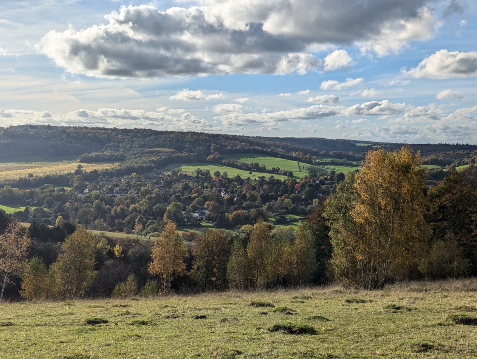
Box Hill is one of the most visited National Trust sites in England, and the summit viewpoint over the Mole Valley is the reason. The walk up rewards you with a panoramic view across Surrey that stretches south towards the Downs. The zigzag path from the valley floor is the most famous approach - stepped and gradual, though it can be slippery when wet.The terrain mixes chalk downland, open scrub, and mixed woodland. Chalk paths drain well and are usually good underfoot, but the shaded woodland sections can hold mud. This is a genuinely interesting walk for dogs, with varied smells and a mix of open and covered ground throughout.
Box Hill is one of the most visited National Trust sites in England, and the summit viewpoint over the Mole Valley is the reason.
Box Hill is popular - particularly at weekends, on Bank Holidays, and in good weather. Weekday mornings outside school holidays are significantly calmer. The summit area has a cafe and is the busiest point on the route. Dogs can be off lead on much of the open downland, though the steeper slopes deserve care, particularly with younger or less sure-footed dogs.
Deer rut · Oct-Nov · Keep extra distance
Tick season · Mar-Oct · Check after every visit
--o
Loading conditions...
Checking weather
Best walk window
--
Fetching live conditions...
Rain
Heat
Wind
Cold
Storm
Based on veterinary research - every dog is different
Breed-specific alerts, humidity-adjusted scoring, and paw burn data in the app
Open in Sniffout
Get live weather for this walk
Today's verdict, hazards, and best time window.
Open Sniffout
Parking Box Hill National Trust car park
Getting there Box Hill and Westhumble station 1.5 miles
Nearest town Dorking
Facilities Cafe at summit viewpoint
Wet weather The chalk zigzag path becomes loose and slippery when wet. Take the longer path around the hill on wet days.
Summer The open downland has no shade. Walk early morning or late afternoon in summer. Water at the summit cafe.
Access notes Conservation grazing on the upper slopes April to October. Leads required when cattle are present.
Difficulty Some hills and uneven ground
Off-lead
PartialOff-lead in sections - check walk description for details.
Water River Mole at the base. Stepping stones accessible in most conditions.
Shade Good shade in the woodland sections. The upper chalk downland is exposed.
Dog facilities Dog-friendly terrace at the National Trust cafe at the summit.
Distance 5.1 km, typically ~1h 30m
TicksDeer present

Box Hill is anchored by the steep zigzag path that climbs the chalk face from the River Mole up to the National Trust viewpoint above. From the top you are looking south across the Weald - a long, wide view that opens up after the enclosed climb through yew and box woodland. The stepping stones across the Mole at the base are the best part for most dogs, especially in summer when the water runs shallow and clear. Off-lead is permitted on the open downland above, though you will sometimes find conservation grazing on the upper slopes - cattle in summer, sheep in early spring - and leads are needed when livestock are present. The zigzag path is chalk rubble underfoot and dry chalk grips well, but it becomes loose and slippery in wet weather; the gradient is steep enough that it is worth considering the long path around instead on a wet day. The National Trust cafe at the top is dog-friendly on the terrace. The Burford Bridge car park at the base fills early on sunny weekends.

Frequently asked questions

Can I take my dog to Box Hill?

Yes, dogs are welcome at Box Hill. Off-lead is permitted on the chalk downland and woodland areas, but keep dogs on a lead near the stepping stones, in the cafe area, and near any livestock. Box Hill is a National Trust site. The main car park at the summit (Burford Bridge or Zig Zag Road) charges for non-members. The terrain includes steep chalk slopes and some unfenced drops near the viewpoint. Livestock occasionally graze the downland during conservation grazing periods.

Get live weather for this walk
Today's verdict, hazards, and best time window.
Open Sniffout
Parking Box Hill National Trust car park
Getting there Box Hill and Westhumble station 1.5 miles
Nearest town Dorking
Facilities Cafe at summit viewpoint
Wet weather The chalk zigzag path becomes loose and slippery when wet. Take the longer path around the hill on wet days.
Summer The open downland has no shade. Walk early morning or late afternoon in summer. Water at the summit cafe.
Access notes Conservation grazing on the upper slopes April to October. Leads required when cattle are present.
Difficulty Some hills and uneven ground
Off-lead
PartialOff-lead in sections - check walk description for details.
Water River Mole at the base. Stepping stones accessible in most conditions.
Shade Good shade in the woodland sections. The upper chalk downland is exposed.
Dog facilities Dog-friendly terrace at the National Trust cafe at the summit.
Distance 5.1 km, typically ~1h 30m
TicksDeer present

Plan this walk with live weather and dog-safe route info

Download on the
App Store
Get it on
Google Play