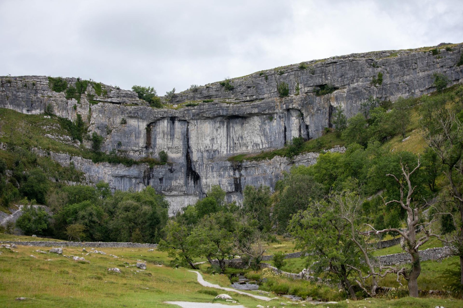
Malham Cove and Gordale Scar
Malham, North Yorkshire
The limestone pavement at the top - blocks of pale grey rock separated by deep cracks - is one of the strangest walking surfaces in England.Dogs can be off lead for much of the walk. The Yorkshire Dales are at their best in late spring and early autumn. Malham village, at the start and finish, has a cafe and toilets. This is a walk with genuine drama packed into a relatively short distance, and worth the journey from most of the north of England.
Malham Cove is a curved limestone cliff face 80 metres high, formed by glacial meltwater and now dry - the stream that once fell over its edge has long since moved underground. The path from the village follows Malham Beck to the base of the cove, then climbs steeply via stone steps on the right-hand side to reach the limestone pavement at the top. The pavement is the reason to come, but it requires care: the deep crevices between the limestone blocks - called grikes - are wide enough in places for a small dog to fall into, and a dog of any size that is prone to scrambling needs to be on the lead here. Sheep are on the farmland sections both on the approach and above the cove; leads are mandatory during lambing from late March through May. The descent is the same steep stone stair you came up. The Beck can be crossed on stepping stones near the village when water levels are low. The Buck Inn in Malham is dog-friendly and serves food year-round.
Frequently asked questions
Can I take my dog to Malham Cove?
Yes, dogs are welcome at Malham Cove. Off-lead is possible on some sections but sheep graze extensively in the surrounding fields, so leads are required through farmland and during lambing season (March to May). The limestone pavement at the top of the Cove has deep crevices (grikes) which can be hazardous for small dogs - keep them on a lead on the pavement. The walk up to the Cove involves a steep climb with stone steps. Parking is available in Malham village (pay and display, can fill up on weekends). The village has a dog-friendly pub.
Plan this walk with live weather and dog-safe route info